For the last geology-related episode of the year, we go out with a bang — magmatic eruptions deep underneath the western Canadian province of British Columbia (B.C.).
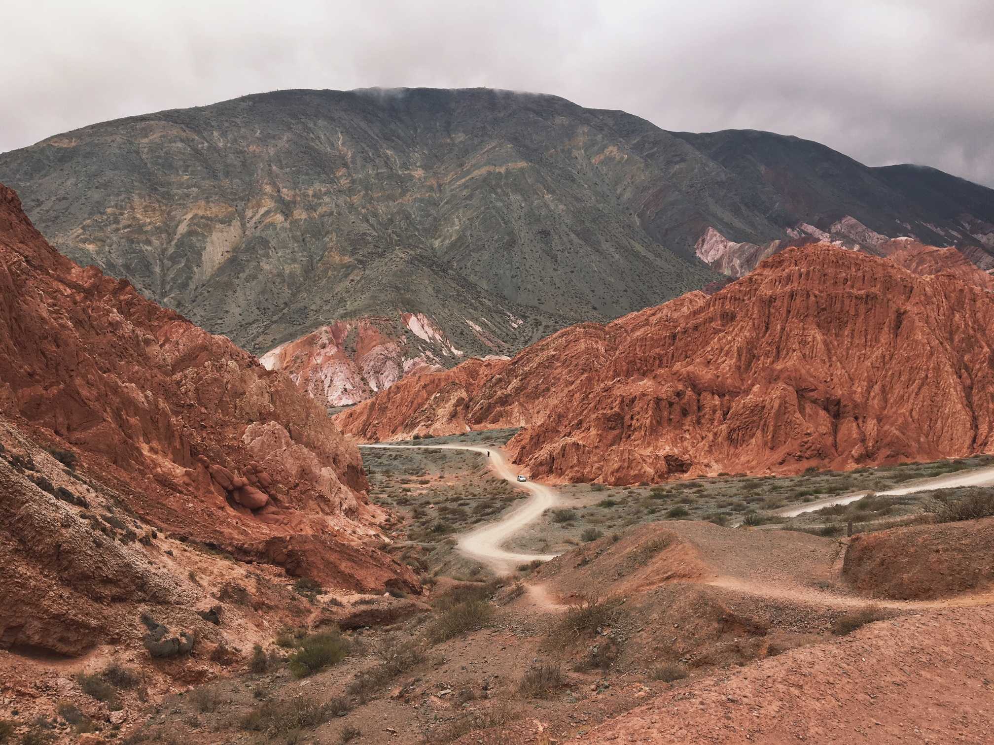
Geologists know that the Coast Mountains are a batholith — a mountainous formation created by numerous plutons deep in the earth’s crust — created during the gradual subduction of various chunks of subcontinental crust under North America between the Jurassic and Eocene periods. But they are still puzzled by the cause of the magmatism under B.C.’s subcontinental crust and what causes the melting of the rocks above the subduction zone.
Geology Professor Margaret Rusmore and her colleagues have been trying to unearth these unknowns for years.
Before diving into their multifaceted study, I will address two probably unfamiliar but vital concepts: subduction and pluton rock. Subduction is the process in which one tectonic plate descends under another plate at a convergent boundary and melts into the mantle, and a pluton is a subsurface rock formation of gradually solidified magma that never ruptured the earth’s surface as does a volcano. Fun fact: “Pluton” is named after the classical ruler of the underworld, Pluto, and “volcano” is named after Vulcan, the ancient Roman god of fire and volcanoes.
Rusmore could probably recite the mechanism of batholith formation in her sleep, but was stumped by the B.C. batholith.
“The problem is, if you are subducting stuff at a pretty constant rate … the magma production should be constant if we understand the system,” Rusmore said. “And that’s not what we see.”
Tiger Lab – Episode 3: Going Out with a Bang—Solving the Magmatic Mystery Under British Columbia. from The Occidental Weekly on Vimeo.
Funded by the National Science Foundation (NSF), Rusmore, Marshall Trautman (senior) and colleagues from University of Arizona, University of Alabama and California State University, Northridge (and three dogs) boated through B.C. to date and geochemically analyze the batholith during the summer of 2014. They observed that a constant influx rate of melting rock corresponded with abnormally intense and sporadic magma outflux.
In order to shed light on this tectonic mystery, Rusmore took to the western range of the Coast Mountains during the summer of 2014 accompanied by Trautman and colleagues from the University of Alabama and the Geological Survey of Canada.
The study consisted of two parts: a three-week boat exploration in the fjords and a month-long helicopter-enabled camping trip through the glaciers.
In May, they flew to Vancouver, Canada, to meet a skipper who captained them in a 50-foot-long boat through the Knight and Bute inlets — fjords that cut deep into the interior of Canada. Trautman said that they were essentially the middle of nowhere, over 100 miles away from real habitation.
“It was the quietest, most remote place ever,” Trautman said.
After the boatwork, the team flew back to California briefly before embarking on the helicopter adventure. The team dropped $2,000 an hour to ride on a helicopter between campsites on the glaciers. Rusmore noted that the approximately $16,000 bill she received after the trip was not the highlight of her summer.
The team was dropped off at each site with three buckets with food to last them a week, and they gradually replaced the food with rock samples. They swapped the rocks with another food bucket when the helicopter returned.
“The most surprising part about this project is how much work it takes to plan a month’s worth of meals,” Trautman said.
They spent an entire day in a supermarket buying non-perishable food such as hot chocolate mix, instant coffee, salami, canned fish, hummus, digestive biscuits, granola bars and beef jerky and then cramming all of it into innumerable plastic buckets.
“You absolutely can’t have a bucket of all the breakfast and a bucket of all the lunch,” Trautman said. “If the helicopter pilot brings the wrong bucket, then suddenly you no longer have dinner and you’re eating instant oatmeal for a week.”
Rusmore and Trautman grew tired of the cabbage and baby carrot salad, but made do.
“You’re starving and it’s the only food for 100 miles, so you’re like, ‘I’ll take it’,” Trautman said.
Each morning after their gourmet bucket-breakfast, the team packed their ice axes, strapped on their crampons and headed out on a carefully-planned route through the glaciers.
Trautman used a geographic information system (GIS)-equipped tablet to record the GPS coordinates and rock sample measurements at each destination. The team analyzed the data along the way to determine their next move.
“Geology takes a lot of interpretation,” Trautman said. “A lot of the work is just sitting out in the field and looking at the mountains and trying to figure out what the hell is going on. Sometimes it’s fun, sometimes I’d find myself napping.”
When their buckets were depleted of food and heavy with rocks, the team returned to the States to perform various analyses of the samples.
Straight off the helicopter, Trautman flew to Tucson to date the samples at the University of Arizona.
“I’m working at part of a small section of a large NSF-funded project,” Trautman said. “It’s this huge project with a goal of trying to figure out how these batholiths formed so rapidly.”
Trautman’s project was made possible by the Occidental’s Undergraduate Research Center and International Programs Office and the Fletcher Jones Foundation, Birman Fund and National Science Foundation.
“My little piece of the pie has been to take different rocks from the mountains and find out how old they are with a series of laboratory techniques,” Trautman said. “Where the magma comes up from the subducting plate and where it moves is something you can tell by the age, size and the relation to each other.”
Trautman used the uranium-lead system of radiometric dating of minerals zircon and titanite found in the granite-like batholith rocks. Uranium radioactively decays into different isotopes with distinct half-lives until it becomes lead. The age of the rock can be extrapolated from the concentration of the original uranium isotope compared to that of its lead product.
Trautman helped date the samples with Arizona’s Laser Ablation Inductively Coupled Plasma Mass Spectrometer (LAICPMS). He operated the machine in shifts of up to 24 hours. In this process, the rock sample is crushed by a machine and the zircon and titanite crystals are isolated in chemical solutions that separate minerals based on density. Using a microscope and tweezers, crystals thinner than a strand of hair are individually mounted in a line on double-sided tape. Epoxy resin is poured over the crystals and, once dried and hardened, the epoxy is polished and imaged with an electron microscope. Up to nine epoxies go into the LAICPMS at a time. With a computer system, the lab technician directs the laser in the spectrometer to blast distinct locations on each crystal to generate a bright plasma on its surface. This allows the machine to detect the elements and isotopes present.
Trautman has dated about a dozen samples so far and is constructing an arc migration rate, the rate at which the age of the rock bands change in the southern range.
He currently approximates a rate of two millimeters per 1,000 years, and has found two significant differences between the radiometric ages of the southern Coast Mountains and its neighbors.
“At about 100 million to 55 million years ago, when there was magma being produced, it formed a much wider zone in the south as opposed to the central and northern ranges,” Trautman said.
According to Trautman, granite in previously studied areas of the Coast Mountains is found in linear arrays with consistent migration arcs. For example, a 50 million year-old granite band would lie next to a 48 million year old band in all of the Coast Mountains—except for the southern range in which it is more likely to find a 40 million year-old band next to a 70 or 150 million year-old one. This shows that there is something different going on between the two areas.
Back at Occidental, Trautman and Rusmore are attempting to map out and conceptualize the rock formation patterns. Trautman said that their data has elicited a lot of head-scratching.
“What is odd is that we see signs of crustal translation in a horizontal sense — strike slip faulting — during the crustal shortening,” Rusmore said. “So it looks like the way the earth behaves depends on crustal depth. If true, this finding complicates our hypothesis that crustal shortening controls the temperature of magmatic flare-ups.”
Crustal shortening puts pressure on rock formations that deforms straight rock layers into wavy bands resemblant of lasagna noodles. Rusmore and the other geologist working on this NSF project hypothesize that the gradual shortening of the crust above the subducting oceanic plate shoves fast-melting sediments from the continental plate down deep enough to where it lowers the melting point of the igneous rock, thus contributing to seemingly random and abnormally large magma bursts.
“We determined it was occurring at the right time to cause these big catastrophic melting events,” Rusmore said
Geologists have determined that shortening is occurring in the eastern range of the Coast Mountains, but this is the first evidence of shortening in the western range, so many questions remain.
“Deep in the stack of rocks, the whole picture seems to change,” Rusmore said. “The rocks either have been stretched along the range while the top is shortening, or maybe there is some sort of strike-slip fault down there that we had no idea about.”
With another year and a half left of the grant, the team continues to analyze their samples. Next summer, Rusmore plans to dig deeper into these unanswered questions.
Trautman is now scrambling to coalesce his data and various hypotheses into a presentation at the Geological Society of America’s Annual Meeting & Exposition in Baltimore November 1-2.
Though their findings are only the tip of the pluton, Trautman is confident that the completed project will deliver groundbreaking results.
“I do suspect that the papers that come out of it will change the particular niche of geology that studies batholiths,” Trautman said.
Rusmore predicts that solidifying the mechanism of the batholith formation will have multi-dimensional implications.
“It fits in the broader geology world because it is one way we make continental crust,” Rusmore said. According to Rusmore, a high proportion of the world’s population lives on continental margins with subduction occurring—and therefore are prone to volcanoes and earthquakes. By figuring out what is going on underneath the Earth’s surface, geologists can assess the safety of living on top of it.
![]()


